
LiDAR Scanning and Drone Mapping for a 10-Building College Campus in Downtown Atlanta
Project Description
Comprehensive Campus Documentation with LiDAR Technology
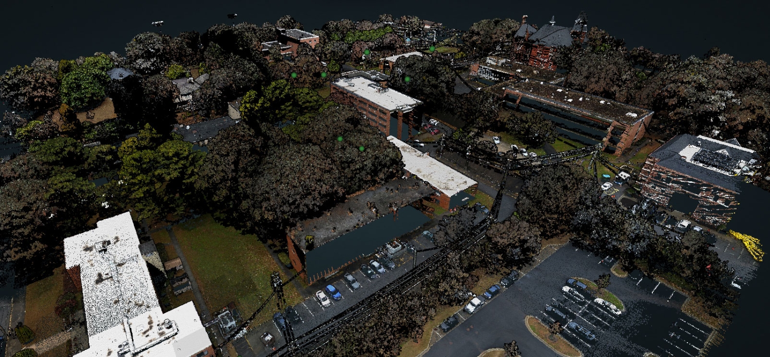
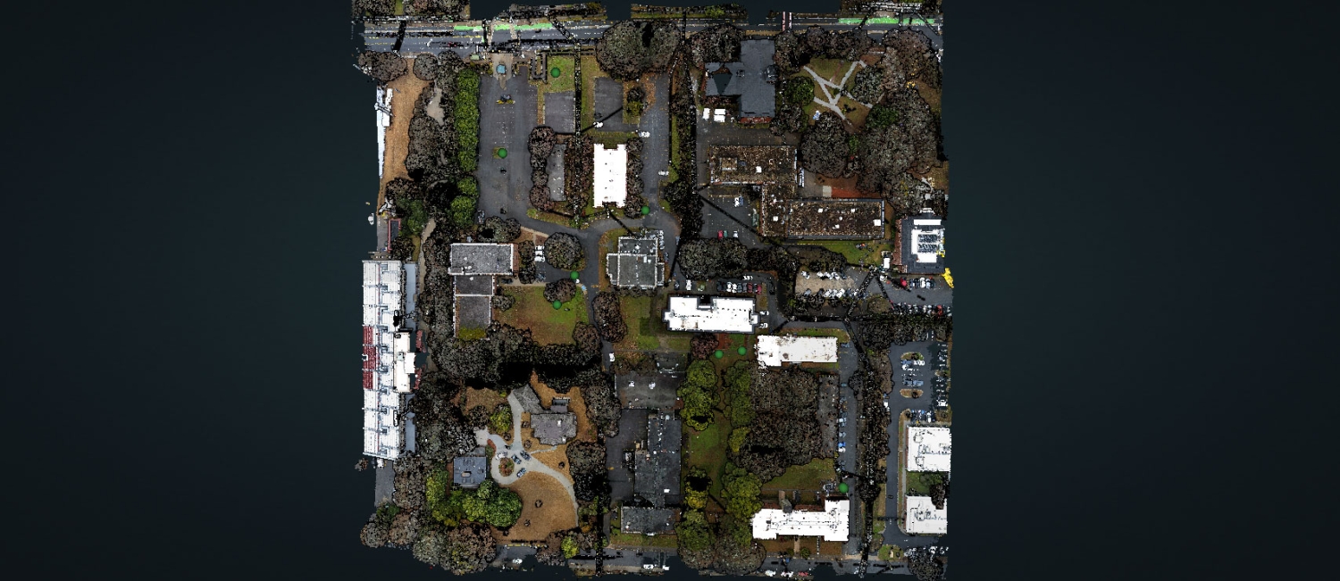
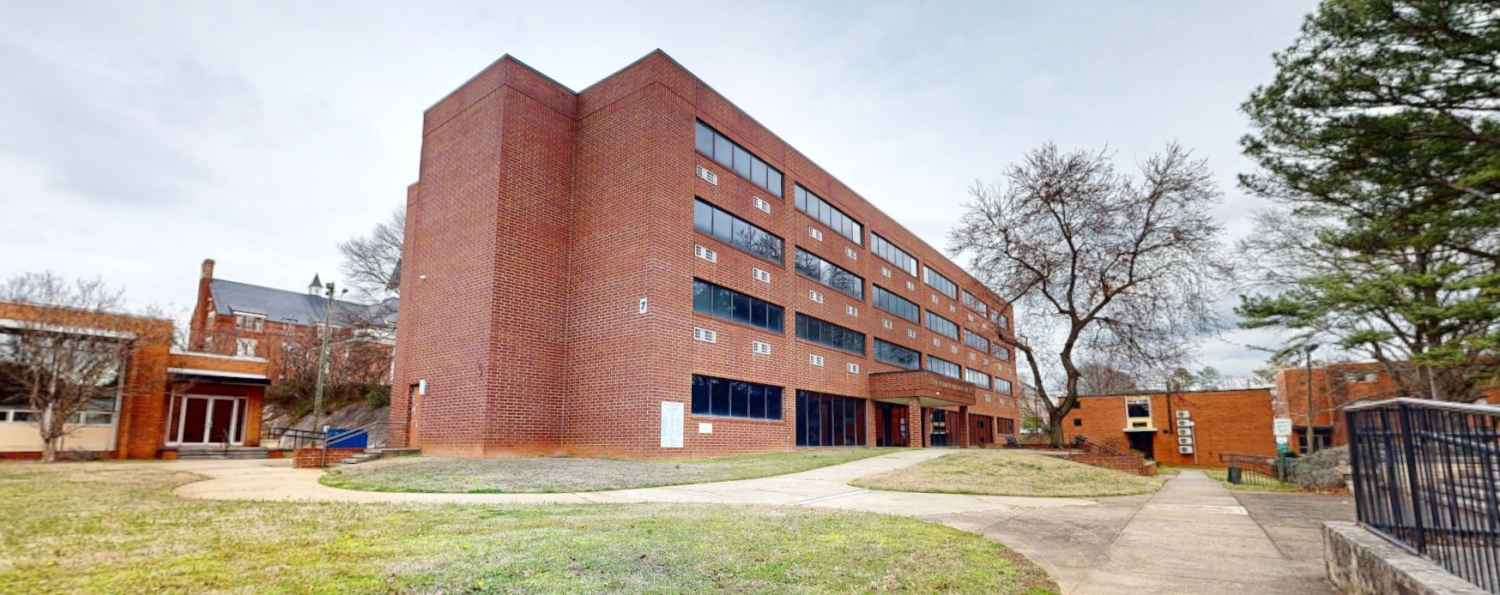
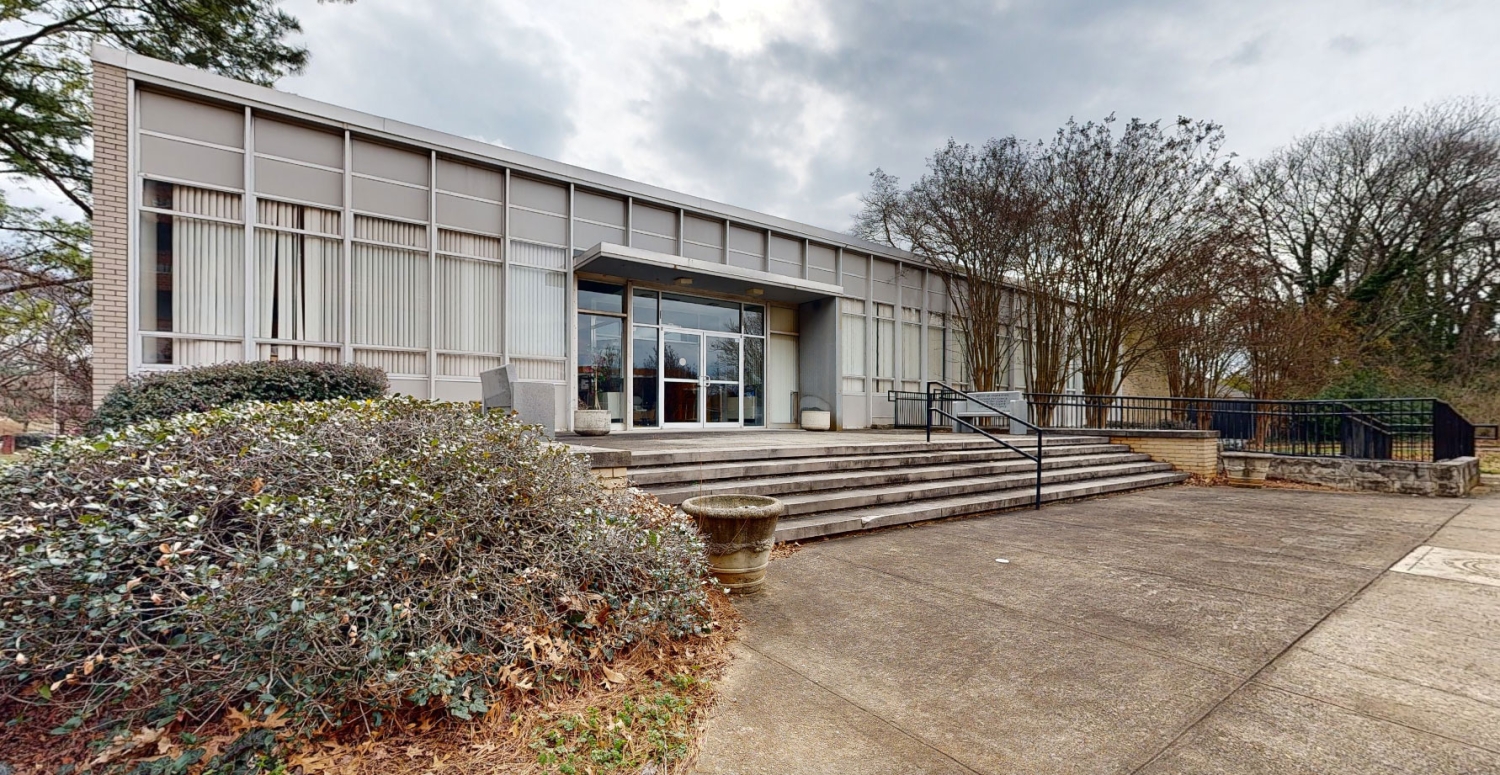
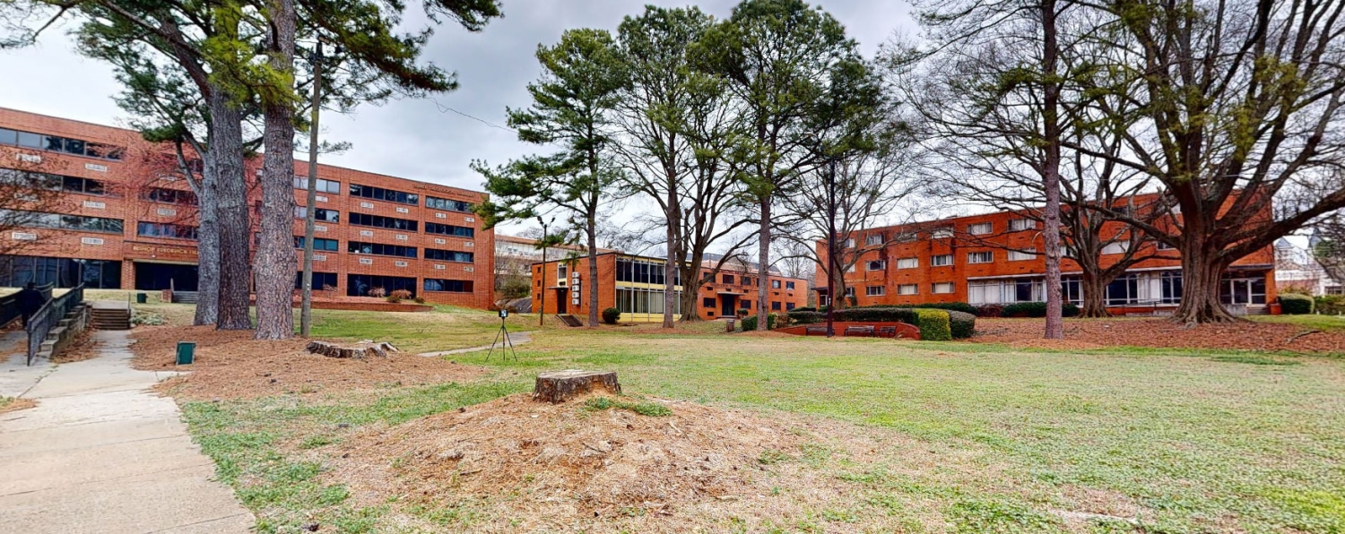
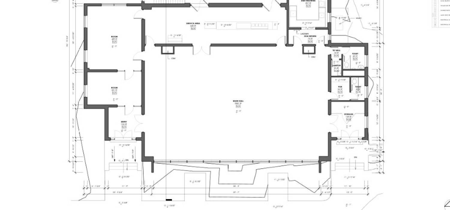
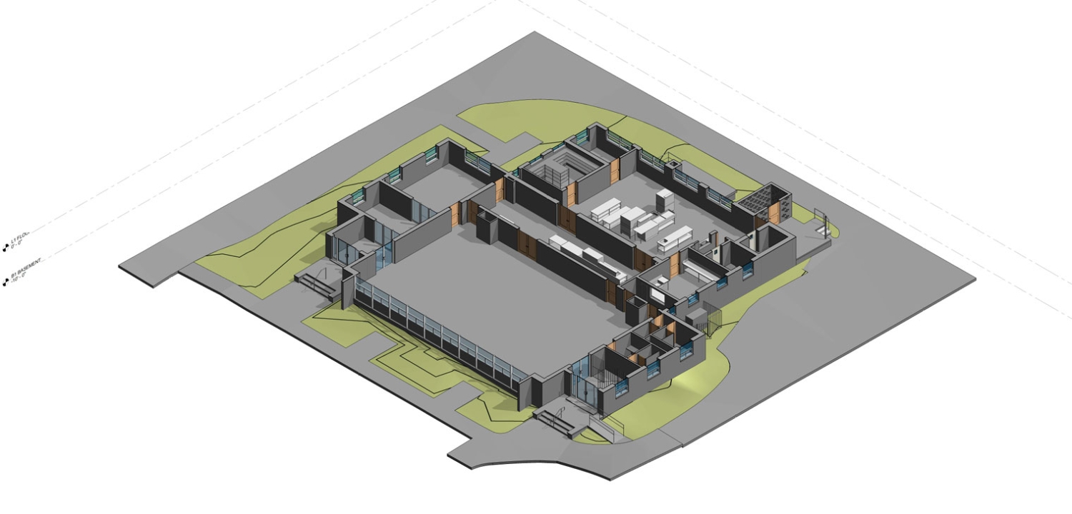
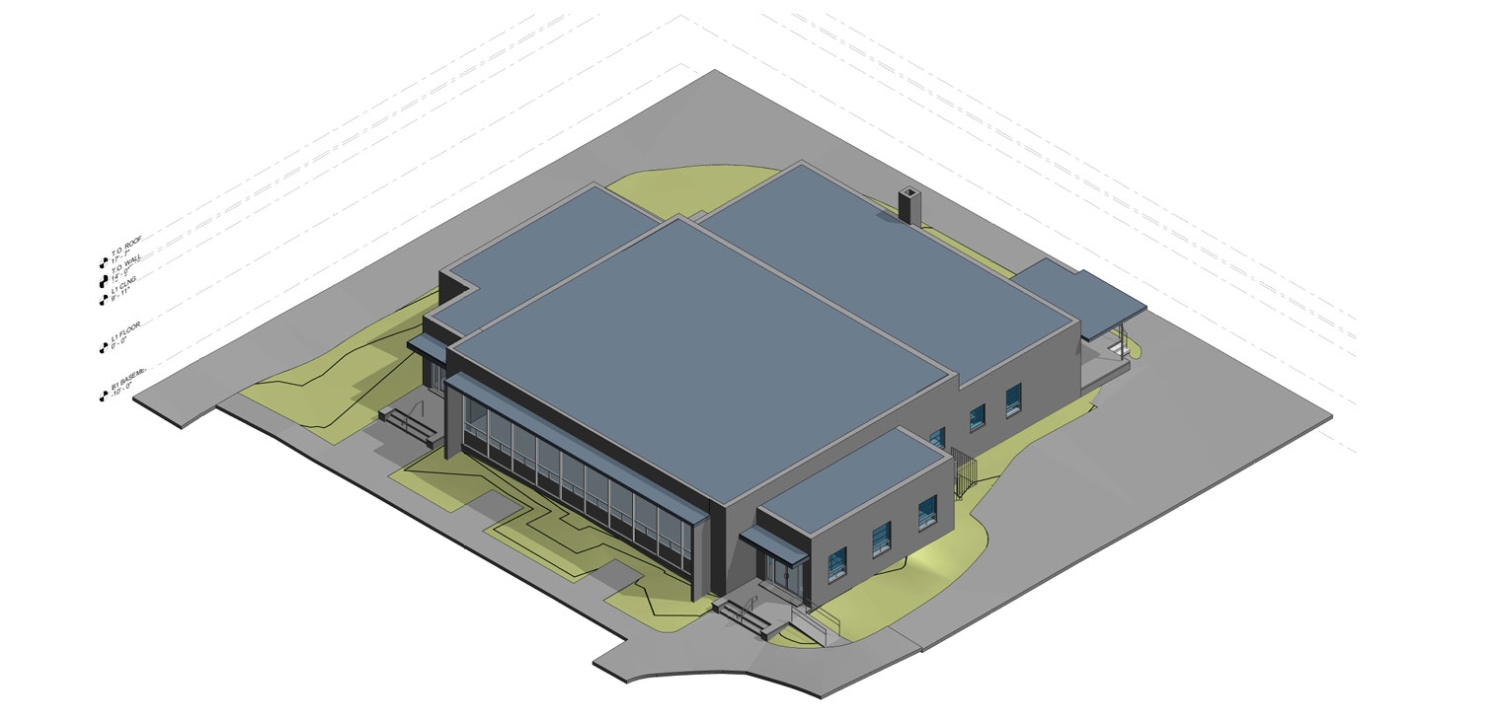
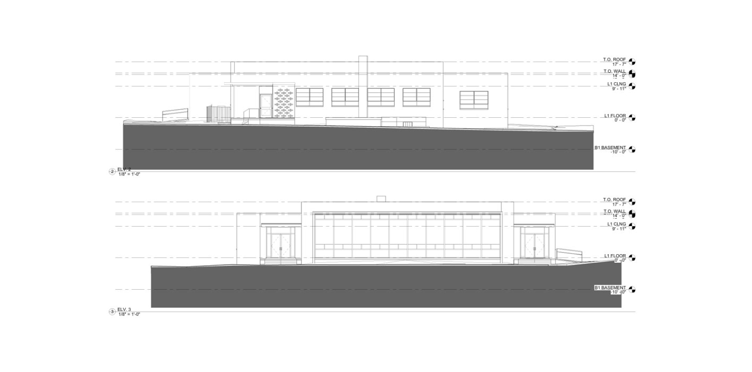
Scan Skunks recently completed a large-scale LiDAR scanning and drone mapping project for a college campus located in downtown Atlanta, Georgia. The project involved capturing detailed existing conditions across an active educational campus consisting of ten buildings and approximately 13 acres of surrounding site terrain. Over the course of three days, a four-person field team utilized a combination of terrestrial LiDAR scanners and drone-mounted LiDAR technology to document both the buildings and exterior site conditions. The final dataset provided architects, engineers, facility managers, and planning teams with an accurate digital representation of the campus, supporting future renovation, redevelopment, maintenance, and planning efforts.
The project encompassed approximately 130,000 square feet of building space, along with extensive site scanning of parking areas, pedestrian pathways, landscaping, utility corridors, and topographic features.
Capturing a Diverse Campus Environment
One of the unique aspects of this project was the varying condition and occupancy levels throughout the campus. Some buildings were fully operational and occupied, while others sat vacant awaiting future renovations or redevelopment. Portions of the campus had experienced deferred maintenance and showed signs of disrepair, while other facilities remained fully functional and actively used on a daily basis.
These varying conditions required careful planning and execution by the Scan Skunks team. Active educational and administrative areas had to be scanned while minimizing disruption to campus operations. Vacant and deteriorated spaces required additional attention to safely document existing conditions while capturing all architectural and structural elements needed for future design work.
The ability to accurately capture facilities regardless of their condition is one of the major advantages of modern LiDAR technology. Whether a structure is occupied, partially renovated, abandoned, or under consideration for adaptive reuse, laser scanning provides a precise record of the building's current state.
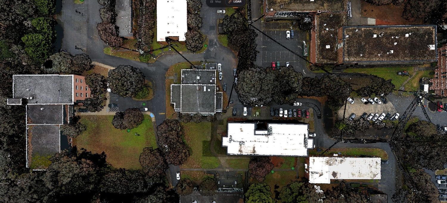
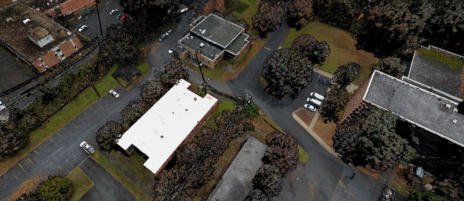
Combining Long-Range and Short-Range LiDAR Scanning
To efficiently document the large campus environment, Scan Skunks deployed both long-range and short-range terrestrial LiDAR scanners.
Long-range scanners were used to capture large open spaces, building exteriors, courtyards, parking lots, and other expansive campus features. These scanners can collect millions of measurements over significant distances, making them ideal for documenting larger areas quickly while maintaining high accuracy.
Short-range LiDAR scanners were used inside the buildings to capture architectural details, classrooms, offices, corridors, mechanical spaces, and other interior features. The combination of technologies allowed Scan Skunks to create a seamless dataset that connected interior building information with exterior site conditions.
This hybrid approach ensured that no area of the campus was overlooked while maintaining the level of accuracy required for architectural, engineering, and construction applications.
Drone LiDAR Mapping of 13 Acres
In addition to terrestrial scanning, the project included drone-based LiDAR mapping of approximately 13 acres surrounding the campus buildings.
Atlanta Drone LiDAR Mapping technology offers significant advantages when documenting large properties, especially in urban environments where traditional surveying methods can be time-consuming. The aerial LiDAR system allowed the Scan Skunks team to rapidly collect topographic information, terrain data, site elevations, parking areas, access roads, sidewalks, retaining walls, and landscape features.
The drone data also helped establish accurate relationships between the various buildings across campus. By integrating aerial LiDAR with terrestrial scans, the project team received a complete digital representation of the site from ground level to rooftop elevations.
For future campus planning, infrastructure improvements, accessibility upgrades, stormwater management studies, and facility expansion projects, this level of documentation provides a valuable foundation for decision-making.
Supporting Future Renovation and Redevelopment Efforts
Educational campuses often evolve over time as buildings are renovated, expanded, repurposed, or replaced. Accurate as-built documentation is critical when planning these projects, particularly on campuses with structures constructed during different eras and using varying construction methods.
The detailed LiDAR data collected by Scan Skunks gives architects and engineers confidence when evaluating existing conditions. Instead of relying on outdated drawings or manual field measurements, design teams can work directly from highly accurate point cloud data.
This reduces surprises during design and construction, minimizes costly field verification visits, and helps improve project coordination among multiple stakeholders. For campuses undergoing phased renovations, having a comprehensive digital record of the entire property also allows future projects to proceed more efficiently, even years after the original scan was completed.
Delivering Accurate Existing Conditions Data
The final deliverable provided the client with a comprehensive digital representation of the campus that can support future architectural design, engineering analysis, facility management, capital planning, and redevelopment efforts.
By combining terrestrial LiDAR scanning, drone LiDAR mapping, long-range scanning technology, and short-range interior scanning methods, Scan Skunks created an accurate dataset that reflects the current conditions of both the buildings and the surrounding site.
For large educational facilities, multi-building campuses, and institutional properties, LiDAR scanning continues to be one of the most effective ways to document existing conditions and establish a reliable foundation for future projects. Scan Skunks specializes in providing these reality capture solutions throughout Atlanta, Georgia, and across the United States.