
Nashville Church Adaptive Reuse Project | LiDAR Scanning and As-Built Modeling
Project Description
Historic Church Documentation for Adaptive Reuse in Nashville
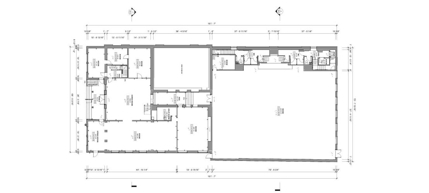
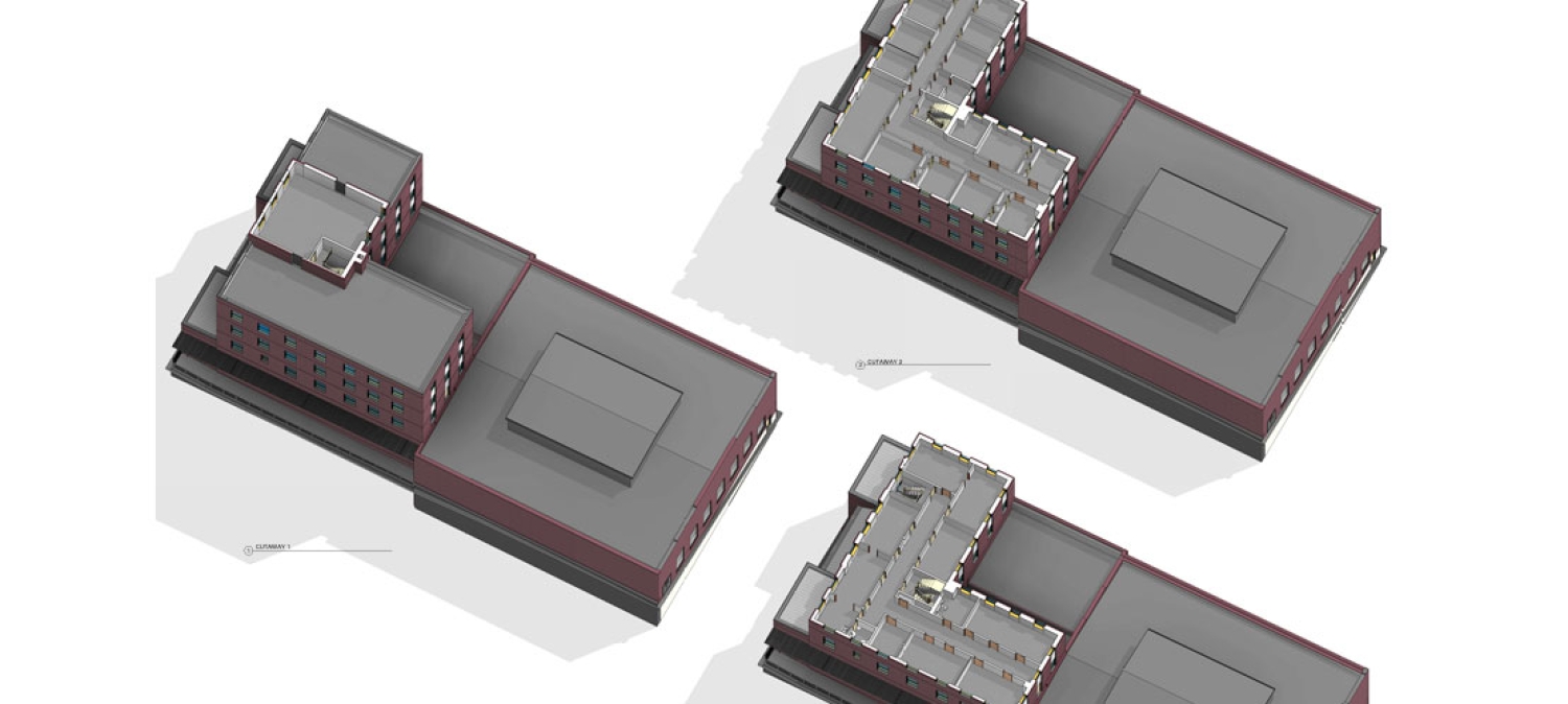
Scan Skunks recently completed a comprehensive LiDAR scanning and as-built modeling project for a historic church property in Nashville, Tennessee. As adaptive reuse projects continue to gain popularity throughout the region, accurate existing conditions documentation has become increasingly important for architects, engineers, developers, and contractors. This project involved capturing approximately 30,000 square feet of building area and the surrounding site to provide a complete digital representation of the property before redevelopment planning began.
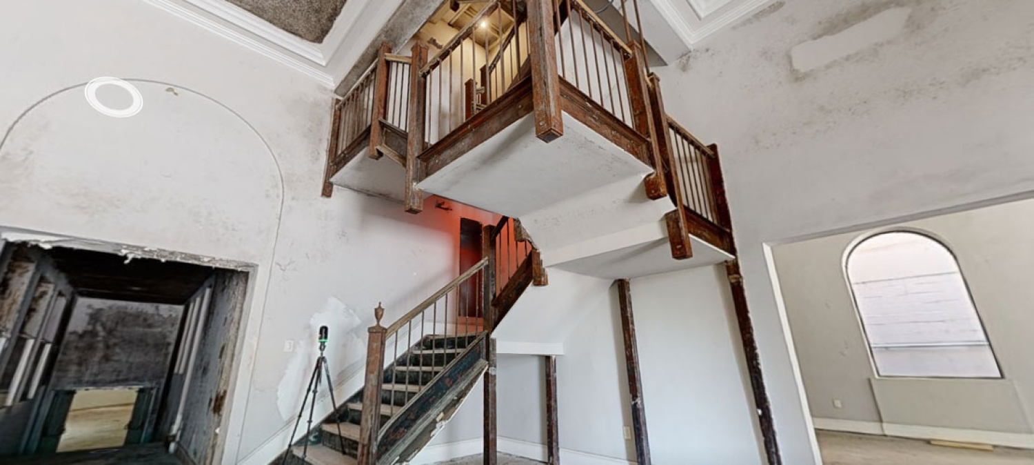
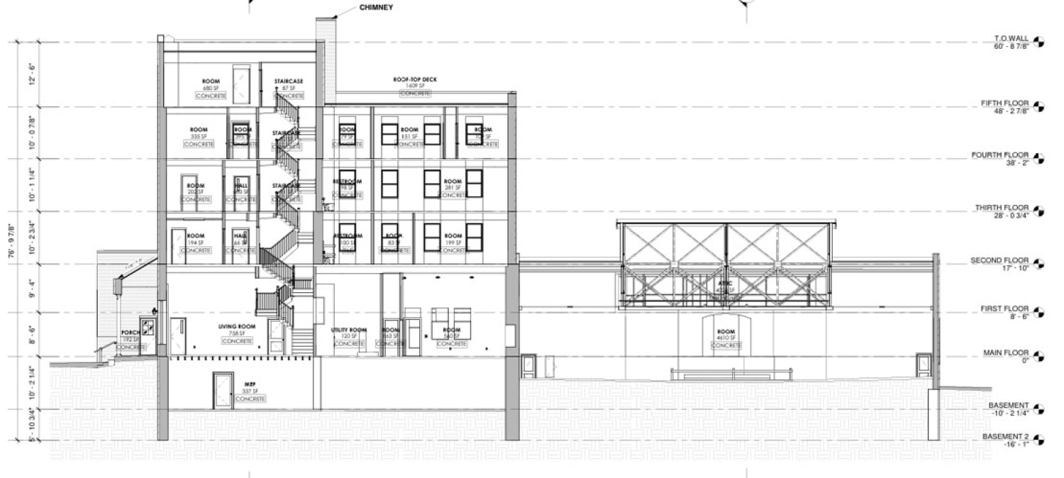
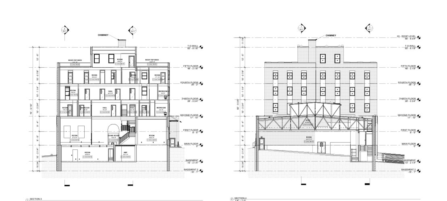
The church consisted of seven total levels, including a basement and roof areas, requiring extensive documentation throughout the structure. The property was vacant at the time of scanning and portions of the building were in varying states of disrepair. Scan Skunks utilized a combination of long-range and short-range LiDAR scanning technology to collect accurate data during a single day of fieldwork. The resulting point cloud data was transformed into a detailed as-built model that provides project stakeholders with reliable information for future design and construction efforts.
Challenges of Scanning a Vacant Multi-Level Church
Historic church buildings often present unique challenges when compared to conventional commercial properties. Over the years, additions, renovations, repairs, and changing construction practices can create inconsistencies throughout a structure. This Nashville church demonstrated many of those characteristics, making accurate documentation essential for the adaptive reuse process.
The seven-story configuration required careful planning to ensure proper alignment between floors. Basement spaces, stairwells, mechanical rooms, and rooftop areas all needed to be captured and accurately connected within the overall model. Maintaining vertical accuracy throughout a building of this size is critical when future design teams begin evaluating structural modifications, accessibility improvements, or new building systems.
The property's condition also added complexity to the project. Areas of deterioration and deferred maintenance can make traditional field measurements difficult and time-consuming. By utilizing LiDAR scanning technology, Scan Skunks was able to safely capture detailed existing conditions without relying solely on manual measurements. Millions of data points were collected throughout the structure, creating a highly accurate digital record of the building's geometry and current condition.
Utilizing Long-Range and Short-Range LiDAR Technology
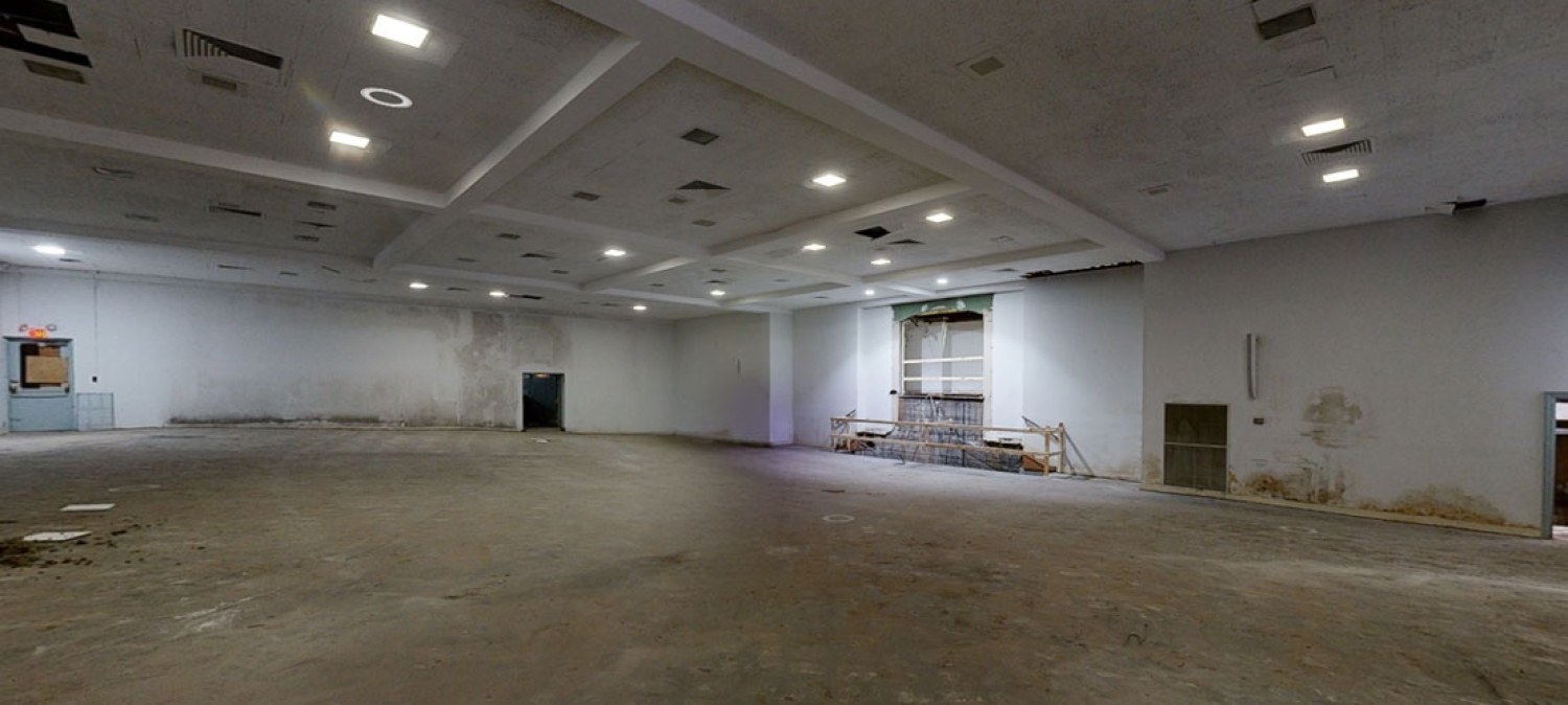
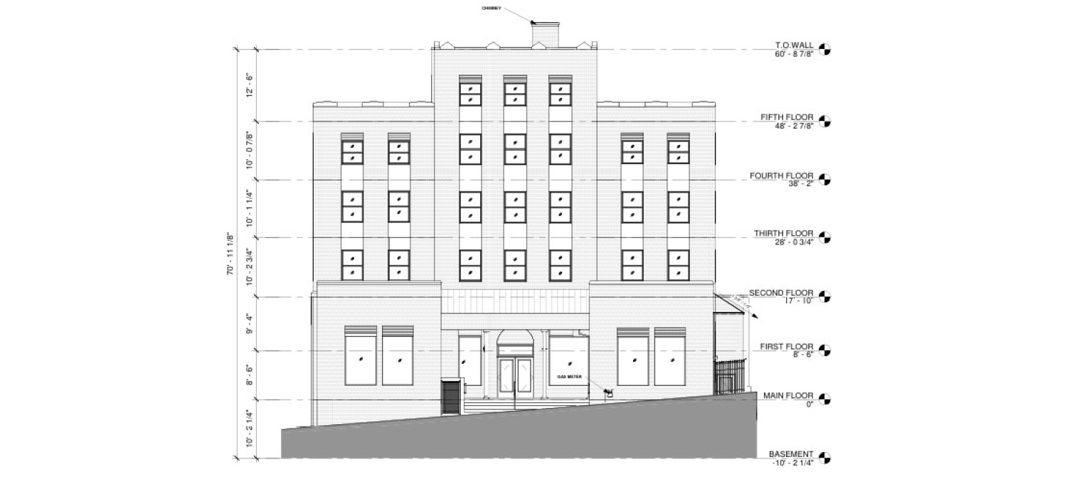
To efficiently capture the entire church and site, Scan Skunks employed both long-range and short-range LiDAR scanning equipment. Each technology served a specific purpose and allowed the team to maximize coverage while maintaining a high level of accuracy. Long-range LiDAR scanners were particularly effective for documenting exterior elevations, site conditions, roof areas, and large interior spaces such as sanctuaries and gathering halls. These scanners can capture extensive areas from a single setup while maintaining precise measurements across long distances.
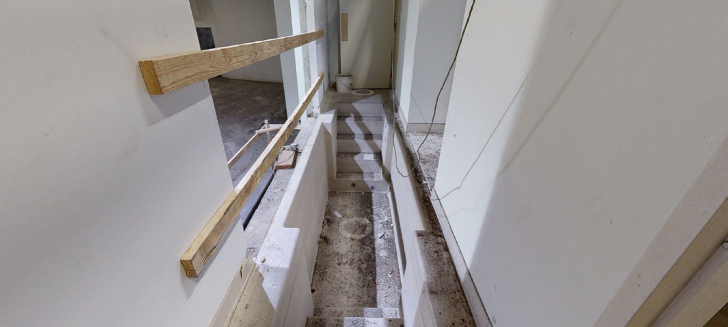
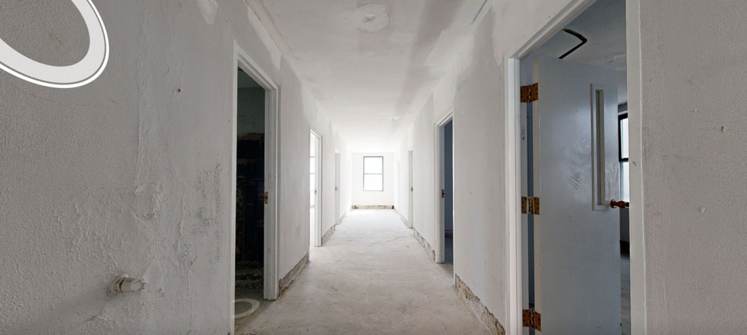
Short-range LiDAR scanners were used throughout areas requiring additional detail and density. Corridors, staircases, utility rooms, architectural features, and tighter interior spaces benefited from closer scanning positions that captured finer building details. By combining these technologies, Scan Skunks created a seamless point cloud dataset that accurately represented the entire structure from the basement to the roof.
This integrated approach provides clients with a complete digital twin of the property, allowing project teams to visualize existing conditions long after the fieldwork has been completed.
The Value of As-Built Models for Adaptive Reuse Projects
Adaptive reuse projects depend heavily on accurate existing conditions information. When older structures are transformed into new uses, design teams must understand the building as it exists today rather than relying on outdated construction drawings or incomplete records. Even when original plans are available, decades of modifications can make those documents unreliable.
LiDAR-generated as-built models eliminate much of the uncertainty associated with redevelopment projects. Architects can design directly from accurate building geometry while engineers can evaluate structural and mechanical systems using reliable existing conditions data. Contractors also benefit from improved coordination during construction because dimensions and building relationships are based on real-world measurements rather than assumptions.
For this Nashville church project, the as-built model serves as a foundational resource for future planning and design efforts. By documenting the entire building and site in a single coordinated dataset, project stakeholders can make informed decisions earlier in the redevelopment process. This often reduces redesign efforts, minimizes costly surprises during construction, and improves overall project efficiency.
Supporting Nashville Redevelopment Through Nashville LiDAR Scanning
Nashville continues to experience significant growth and redevelopment activity, creating new opportunities for adaptive reuse of historic properties. Churches, schools, industrial facilities, warehouses, and commercial buildings are increasingly being evaluated for conversion into new residential, office, retail, hospitality, and mixed-use developments.
Projects like this historic church demonstrate the importance of accurate building documentation before design work begins. Scan Skunks provides developers and design professionals with precise existing conditions data that supports informed decision-making throughout every phase of a project. Through advanced LiDAR scanning technology and detailed as-built modeling services, our team helps clients reduce risk, improve coordination, and accelerate project timelines.
By completing the entire 30,000-square-foot building and site scan in just one day, Scan Skunks delivered a comprehensive digital representation of this Nashville church property that will continue to provide value throughout the adaptive reuse process. The resulting model gives project stakeholders the confidence needed to move forward with planning, design, and redevelopment efforts while preserving the character and history of the existing structure.