
LiDAR Scanning a 9,000 Square Foot Lakefront Barndominium Near Nashville, TN
Project Description
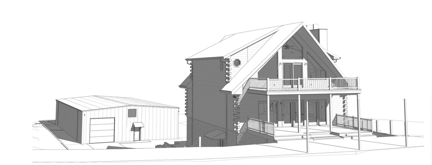
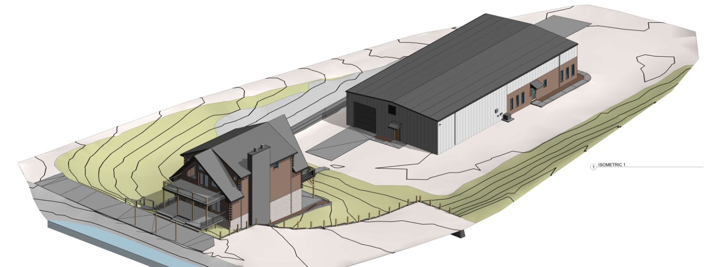
When planning a large-scale residential renovation, accurate existing conditions documentation is critical. Scan Skunks recently completed a comprehensive Nashville and Brentwood LiDAR scanning project for a private 9,000-square-foot lakefront home and barndominium located outside of Nashville, Tennessee. The project required capturing detailed as-built information for a future renovation while navigating steep terrain and challenging site conditions.
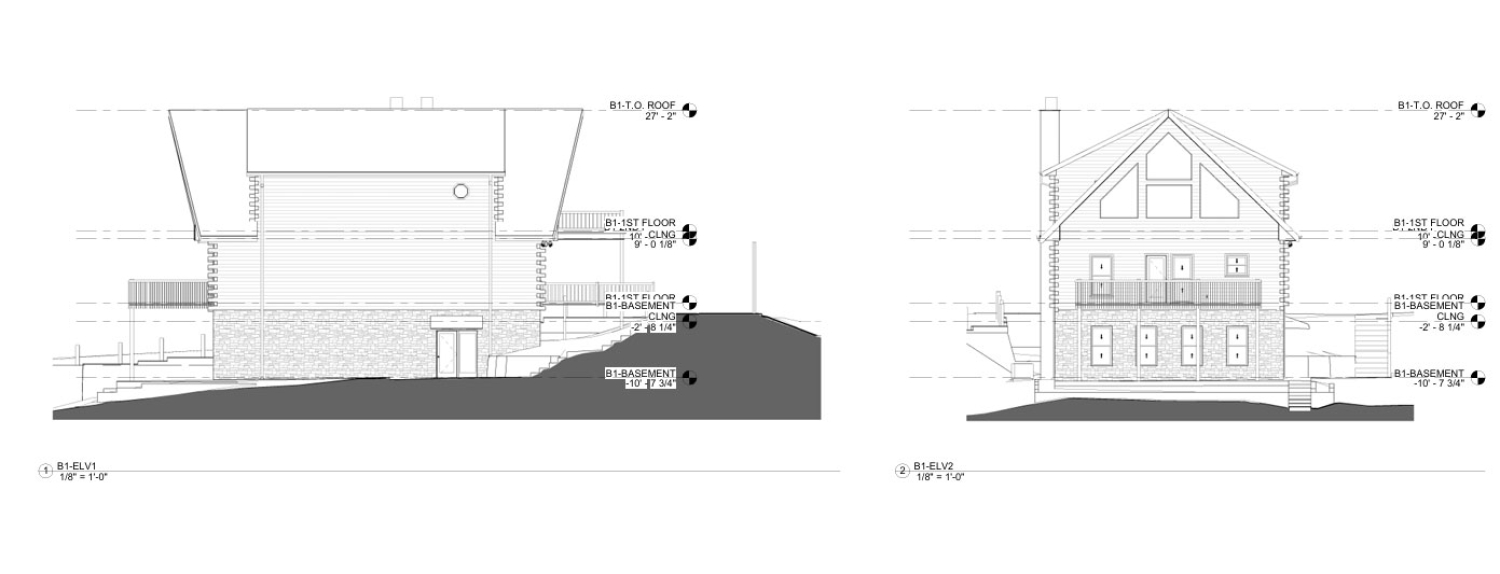
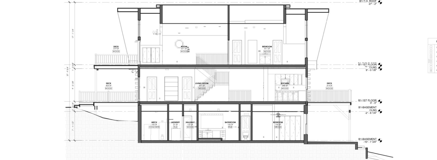
Through a single day of fieldwork, our team successfully captured the property and delivered a complete digital documentation package, including a 3D Revit model, 2D CAD drawings, and an interactive virtual tour. These deliverables provided the design and construction teams with the accurate existing conditions needed to move forward with confidence.
Capturing Existing Conditions for a Lakefront Renovation
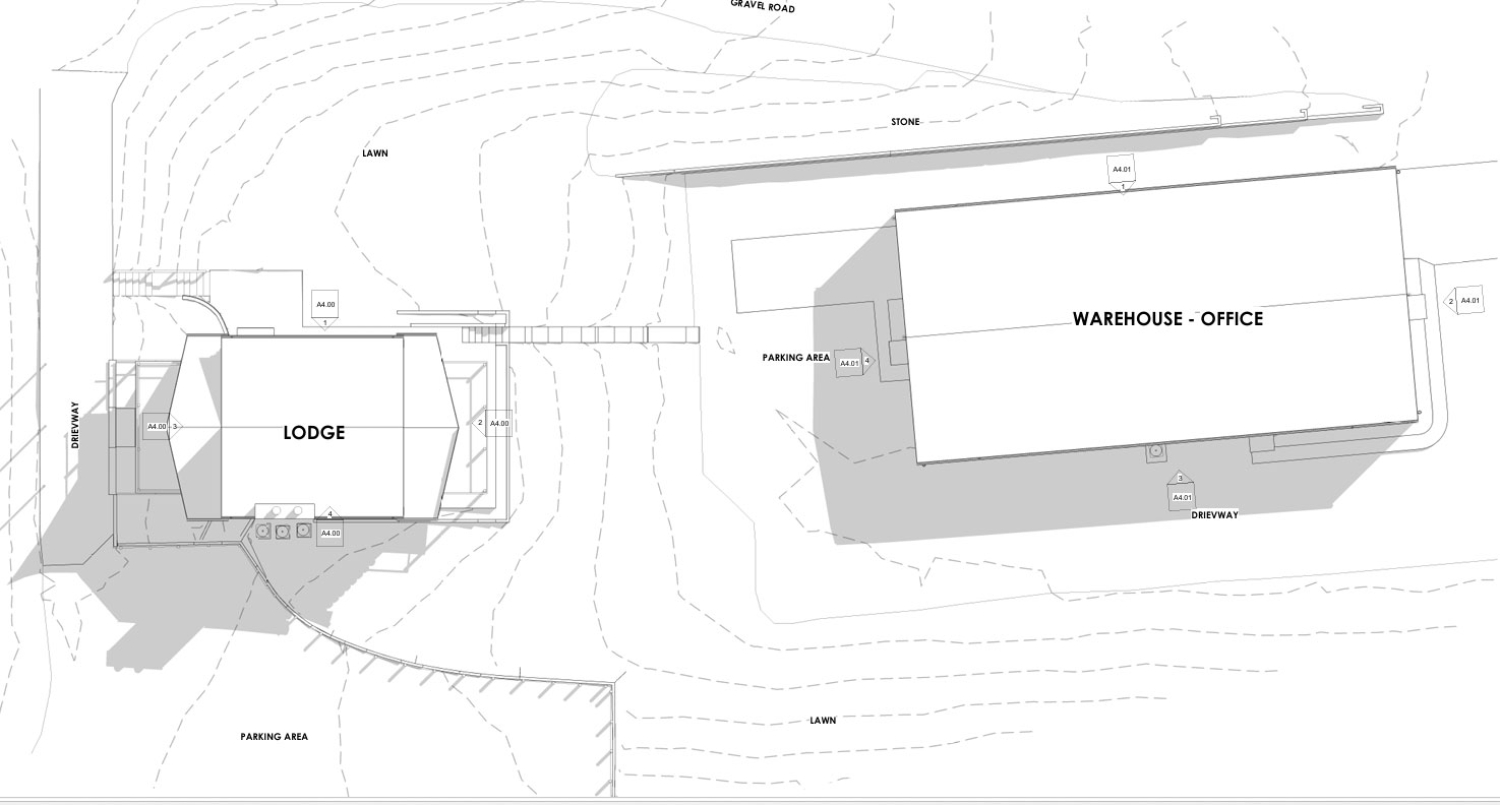
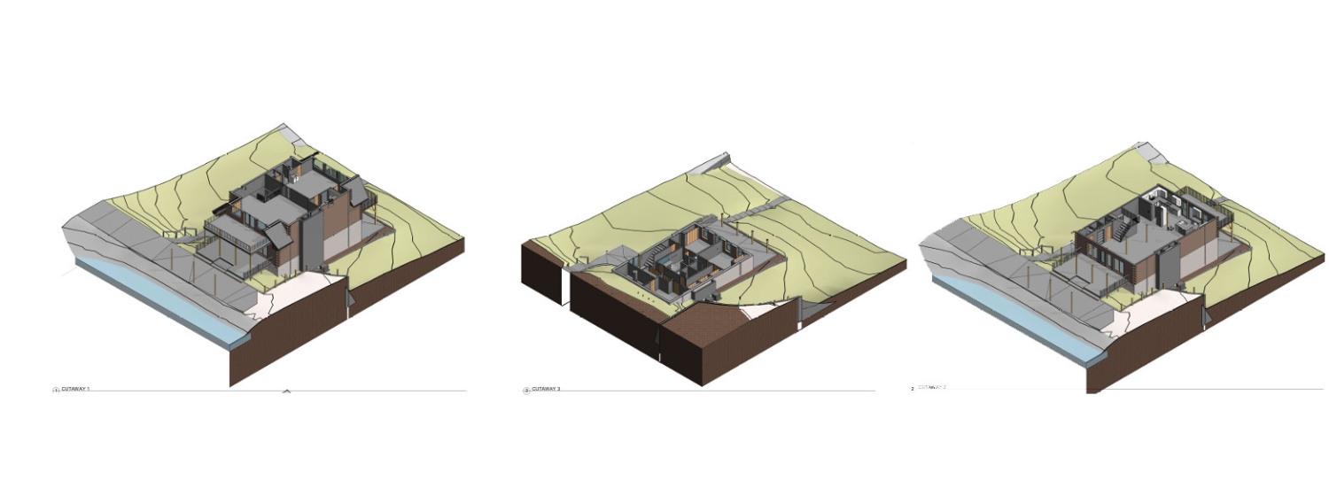
Large residential properties often present unique challenges during renovation planning. Unlike commercial buildings with readily available documentation, custom homes and barndominiums frequently undergo modifications throughout their lifespan, making original plans unreliable or outdated. For this project, the homeowner and design team required highly accurate as-built documentation before beginning renovations. The property consisted of approximately 9,000 square feet of living and utility space, blending traditional residential construction with barndominium-style architecture. By utilizing terrestrial LiDAR scanning technology, Scan Skunks was able to rapidly capture millions of precise measurement points throughout the structure. This process created a highly detailed digital representation of the property that could be used for design, engineering, and construction planning.
Challenges of Scanning on Steep Terrain
One of the most significant challenges of this project was the property's location along a lakeside hillside. The steep terrain created access difficulties not only for future construction but also during the scanning process itself.
Elevation changes around the structure required careful planning to ensure complete coverage of the exterior and surrounding areas. Traditional measurement methods would have required significantly more time and introduced opportunities for human error.
Our team strategically positioned scanning equipment throughout the property to capture accurate geometry while maintaining safe access across varying elevations. Multiple scan positions were carefully registered together to create a seamless point cloud representing the entire structure and surrounding site conditions.
The ability to capture accurate measurements regardless of terrain is one of the major advantages of LiDAR scanning for residential projects, especially on properties where slopes, retaining walls, and elevation changes are common.
One-Day Data Collection for Maximum Efficiency
Time on site is often a concern for homeowners, especially when a property remains occupied or is actively being prepared for renovation.
Using advanced LiDAR scanning technology, Scan Skunks completed the entire field capture in a single day. This efficient approach minimized disruption while still collecting the comprehensive data required for detailed modeling and documentation.
Rather than spending days manually measuring walls, ceilings, rooflines, and structural components, the LiDAR scanner captured millions of measurements in a fraction of the time. The result was a complete digital record of the property that could be referenced throughout the renovation process.
Interactive Virtual Tour for Remote Collaboration
As part of the final deliverables, Scan Skunks also created an interactive virtual tour of the property.
Virtual tours provide a powerful tool for project teams, especially when multiple consultants are involved. Architects, engineers, contractors, and owners can remotely explore the property from virtually anywhere without needing to schedule additional site visits.
The virtual tour serves as a visual reference that complements both the Revit model and CAD drawings. Team members can review room layouts, examine existing conditions, and better understand spatial relationships throughout the structure.
For lakefront properties and custom homes, virtual tours often become a valuable resource throughout the renovation process, allowing stakeholders to revisit the site digitally whenever questions arise.
Why LiDAR Scanning Is Ideal for Residential Renovations
Residential renovation projects frequently encounter surprises hidden behind walls, within roof structures, or beneath additions that have been constructed over many years. Accurate existing conditions documentation helps minimize these unknowns before construction begins.
LiDAR scanning offers significant advantages for homeowners, architects, and contractors by providing highly accurate measurements, faster data collection, and comprehensive digital deliverables. For complex homes such as this 9,000-square-foot lakefront barndominium near Nashville, the technology creates a reliable foundation for successful project planning.
With steep terrain, unique architecture, and extensive renovation goals, this project demonstrates how modern reality capture technology can simplify the planning process while providing exceptional accuracy for future design and construction efforts.
Scan Skunks continues to provide professional LiDAR scanning, 3D modeling, as-built documentation, CAD drafting, and virtual tour services for residential, commercial, hospitality, industrial, and institutional projects throughout Tennessee and across the United States.